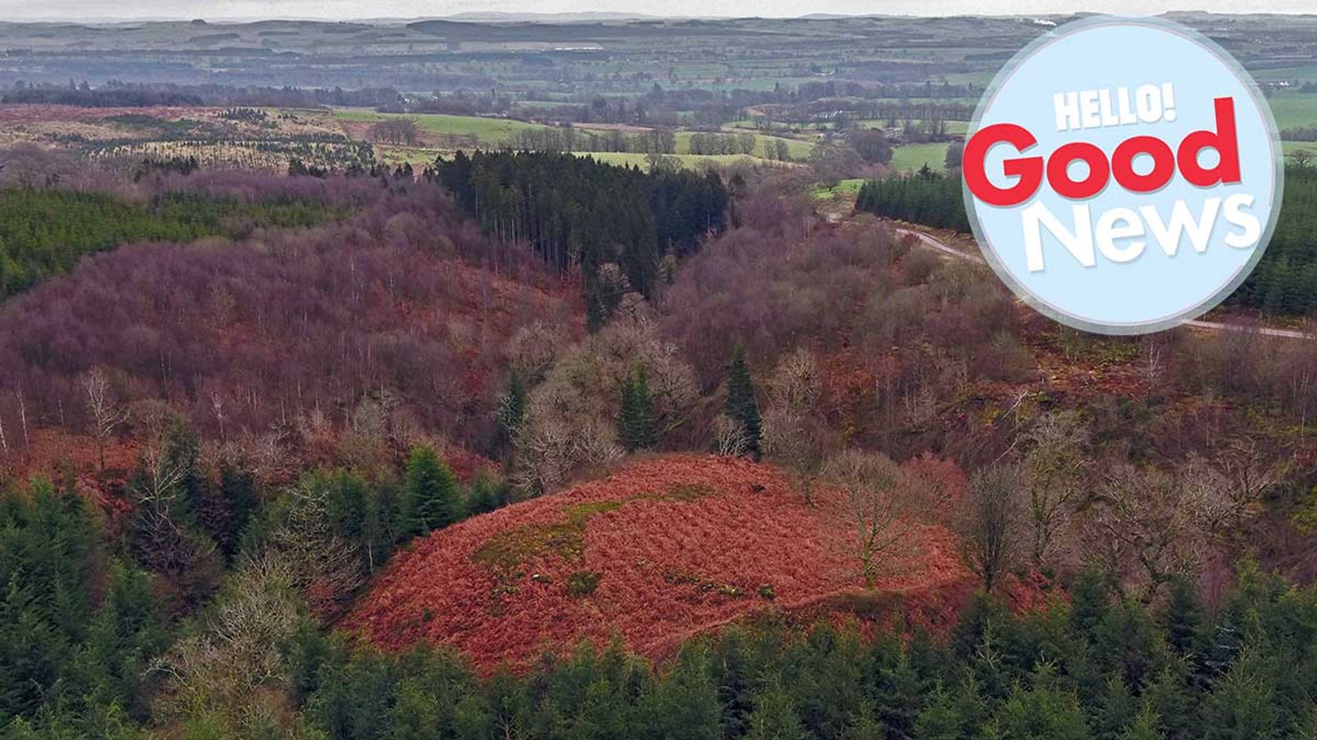
A hidden fort believed to be have been built by Scottish freedom fighter Sir William Wallace and his men has been discovered in southern Scotland. The site, near Lochmaben, is recorded in The New Statistical Account of Scotland, published 1834-1845 as the location of a small fort occupied by Wallace – a hidden stronghold where he and his 16 men would "sally forth to annoy the English". A new archaeological survey by Forestry and Land Scotland (FLS) investigated the site in Dumfriesshire, where the fort is believed to have once stood, using a drone. Hundreds of photographs were taken by aerial footage experts Skyscape Survey, and the images stitched together to create a 3D model of the hidden site.
 © FLS by Skyscape Survey 2020
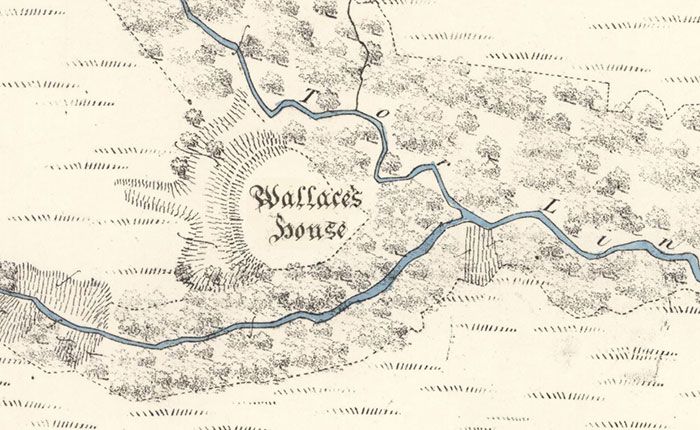
The original Ordnance Survey map, with William Wallace's house clearly marked
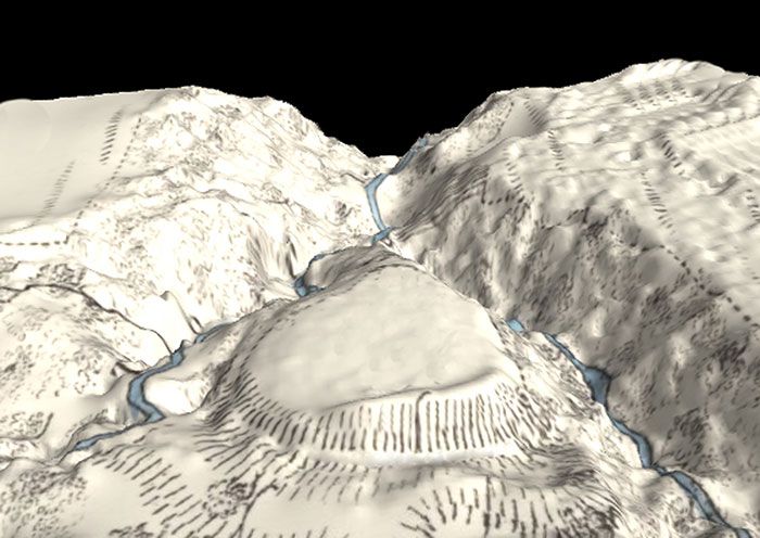
FLS archaeologist Matt Ritchie explained: "Hundreds of photographs taken from the air by remote-controlled drone are stitched together using point-matching software to create a 3D terrain model, stripping away scrub and ground vegetation. Height detail is refined by adding close contours and orthographic colour. It's a fascinating and revealing technique that really begins to open up the landscape and this seemed like an ideal site to investigate."
SEE: People are dressing up as their favourite classic works of art

Scottish freedom fighter Sir William Wallace
The small fort was described by The New Statistical Account of Scotland as Wallace's House, built on a summit with an "extensive view" to the south and protected by a large fosse (or ditch) which "must have been a strong place of defence". It continued: "Sir William Wallace, while meditating the capture of the castle of Lochmaben in 1297, is said to have kept 16 men there, with whom he sallied forth to annoy the English garrison."
MEET: There's a new species of snake named after a Harry Potter character
 © FLS by Skyscape Survey 2020
The new 3D model shows the terrain of the site
"The new contour model adds to a history of cartographic work that began with the Ordnance Survey in 1857," Matt continued. "It must have been the 'strong place of defence' described by the Account, the rampart topped with a timber palisade and enclosing timber buildings built to house the soldiers and their horses. But could the fort really have been built by William Wallace and his men? I'd like to think so – and, either way, the survey has added a new chapter to an old story!"
Do you have some Good News you'd like to shout about? Email our Good News ambassador Toff at toff@hellomagazine.com to share your story and visit our Good News channel for more feel-good stories.


